CCTV News:The latest data show that the discharge of major water pollutants in China continued to decline last year, and the goal of improving the quality of water ecological environment was successfully completed. The ecological environment of great rivers and lakes is getting better and better.
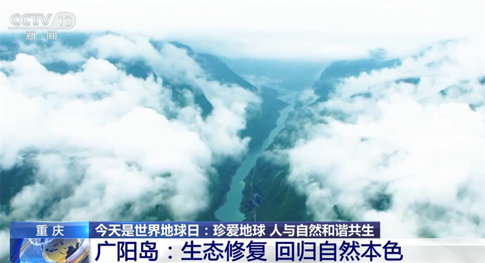
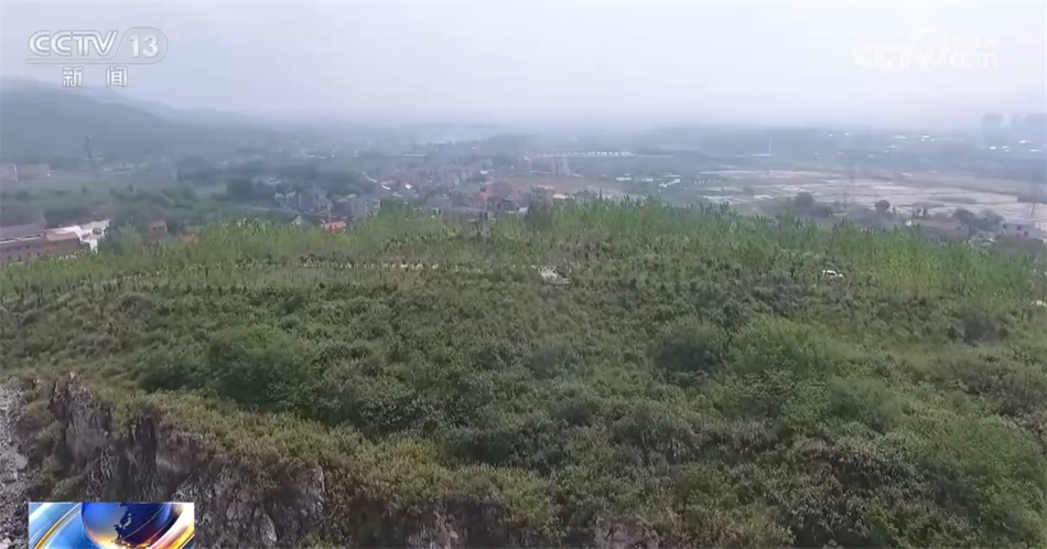
Guangyang Island in Chongqing is the largest green island in the upper reaches of the Yangtze River, covering an area of about 10 square kilometers. Through satellite remote sensing images, we can clearly see that the jungle of Guangyang Island is dense and Shan Ye is beautiful. And 10 years ago, local ecology was destroyed by real estate development here.
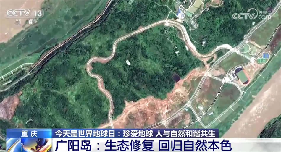
Wang Yue, Executive Deputy Director of the Leading Group Office of Guangyang Island Area in Chongqing:It has left many traces of development, and the small-scale terraces and natural water system textures formed over thousands of years no longer exist.
In 2017, Guangyang Island was pressed the "stop button" for large-scale development, and then the National Yangtze River Office approved the 168-square-kilometer Guangyang Island area with Guangyang Island as the core to carry out the green development demonstration of the Yangtze River Economic Belt. Today, 23 demonstration sites of ecological restoration have been built on the island, including Shangba forest, rape field, Daidai grass field and Shengli grassland, and the number of animal and plant species recorded on the island has increased by about 400. Hillside, streams, forests and wetlands are in harmony, and Guangyang Island is gradually returning to its natural color.
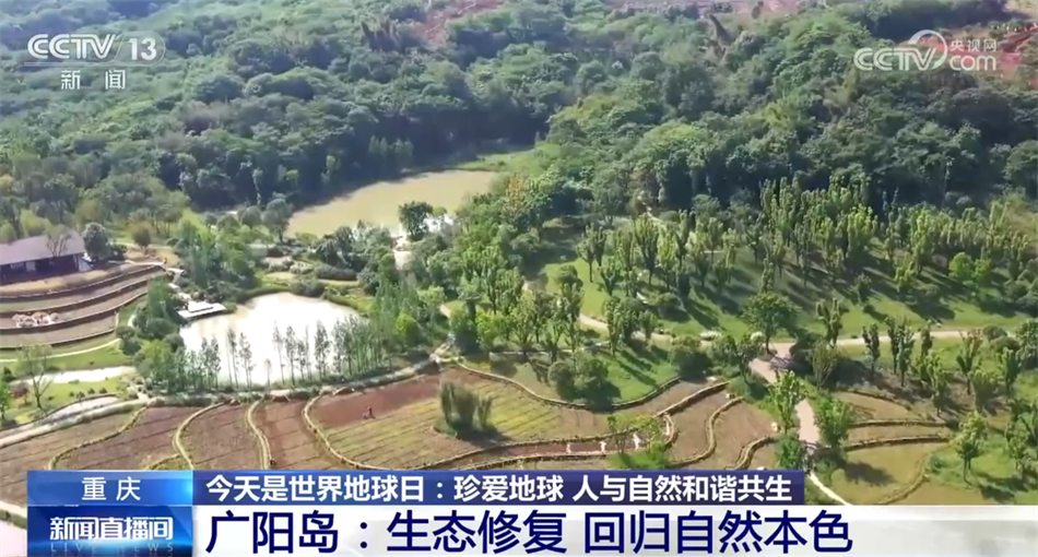
Wang Yue, Executive Deputy Director of the Leading Group Office of Guangyang Island Area in Chongqing:The purpose is to lead the whole Chongqing to play an exemplary role in the green development of the Yangtze River Economic Belt through Guangyang Island and Guangyang Island area.
Hunan: Harnessing and Repairing Exposed Mines Dongting Ecology continues to improve.
Crossing Chongqing, we continue to look downstream along the Yangtze River through high-scoring satellites, and the ecology of the 800-mile Dongting continues to improve. As the second batch of national integrated protection and restoration projects of landscape, forest, field, lake, grass and sand, the landscape project of Dongting Lake, a key ecological zone in the Yangtze River Economic Belt in Hunan Province, is being stepped up. In the vicinity of East Dongting Lake, in order to effectively carry out the treatment and restoration of bare mines, the local natural resources department used the laser scanning real-life three-dimensional technology for the first time to restore the actual face of the mine through satellite positioning and laser scanning imaging, providing technical support for subsequent greening.
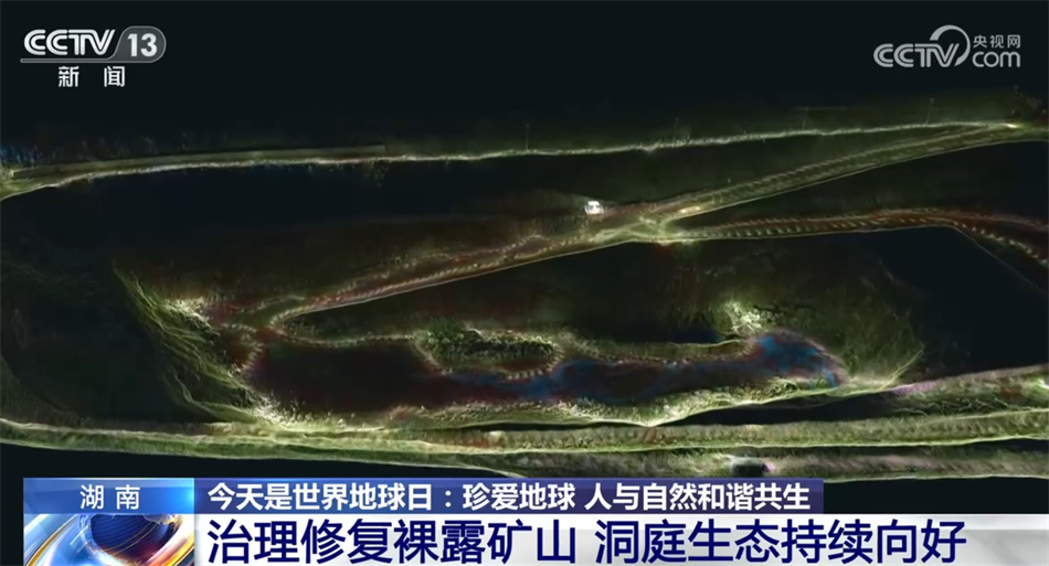
Xu Song, Director of Yueyang Natural Resources and Planning Bureau:After three-dimensional restoration, we can analyze the data according to the presented images, and delimit the corresponding revegetation areas according to the geographical information, mining slope and ground flatness, so as to ensure the survival rate of vegetation seedlings.
According to reports, the ecological protection and restoration area of the Dongting Lake regional landscape project in the key ecological zone of the Yangtze River Economic Belt in Hunan Province is 796.93 square kilometers. At present, 50 sub-projects of 7 major projects are under construction one after another, involving 27 counties and cities in Yueyang, Changde and Yiyang. It is planned to fully complete the target tasks by the end of 2024.
关于作者